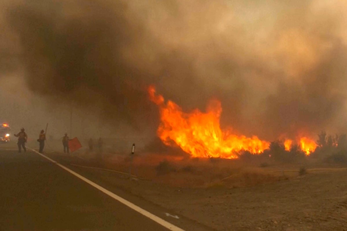
When a wildfire moves fast, tracking apps break, phone alerts shriek, and people have minutes to decide what decades of their lives to leave behind. That is the reality playing out in northwest Reno, Nevada, where the human-caused Hawk Fire erupted across the Peavine Peak area.
About 90,000 people suddenly found themselves trapped in mandatory evacuation orders or warning zones as the uncontained blaze tore through the Sierra foothills. If you think a wildfire gives you plenty of warning, the speed of this disaster proves otherwise. Flames moved so aggressively on Saturday night that they jumped over fire trucks, blinding crews to hot spots and rendering standard tracking tools dangerously outdated. Don't miss our recent article on this related article.
How a Small Spark Became a Regional Crisis
The fire started on Saturday near Hawk Meadow Trail, initially looking like a minor incident that barely registered on anyone's radar. Tyler Duvall, a local resident interviewed by media outlets, went camping thinking the smoke was nothing to worry about. By Sunday, his home sat squarely inside the evacuation zone.
Gusty winds, extremely dry vegetation, and low humidity transformed the terrain into a tinderbox. The blaze ballooned past 15,000 acres with zero containment, pushing toward densely populated neighborhoods and brushing the edge of the University of Nevada campus. To read more about the history here, NBC News offers an excellent breakdown.
Nevada Governor Joe Lombardo declared a state of emergency for Washoe County, dispatching the Nevada National Guard with two helicopter crews and 60 troops to help secure abandoned streets. Nearly 10,000 customers lost power, major highway segments like U.S. Route 395 were shut down, and local schools canceled classes. Six people, including three first responders, sustained injuries amid the chaos.
The Flaws in Modern Emergency Preparedness
People rely heavily on technology during natural disasters, but the Reno emergency exposed major gaps. Families tracking the fire via mobile apps discovered too late that digital maps lagged far behind the actual flames. When wind directions shift every few minutes, digital feeds cannot keep up.
Local authorities, including Washoe County Sheriff Darin Balaam, stressed a blunt message: get out immediately rather than waiting for an app to confirm danger. Evacuating 90,000 people creates massive gridlock. When thousands of cars hit the same arterial roads simultaneously, evacuation routes turn into parking lots.
Shelters opened quickly at locations like the Reno-Sparks Convention Center, but pet logistics created immediate friction. Evacuees were forced to separate from their animals because standard human shelters couldn't house pets, requiring separate intake points for small and large animals. These friction points highlight what emergency planners frequently overlook: families will delay evacuation if they cannot keep their pets safe.
Preparing Before the Smoke Appears
Wildfire behavior has changed. Fires don't just burn slowly through timber anymore; they jump highways, outrun trucks, and ignite suburban roofs via flying embers. If you live in an interface zone near dry brush, waiting for a mandatory knock on the door is a dangerous gamble.
- Keep a go-bag packed with vital documents, medications, and essentials by the front door.
- Designate an out-of-state contact person so separated family members can check in easily.
- Map out multiple physical evacuation routes away from major bottlenecks.
- Plan where your pets will go before a local emergency forces split-second choices.
Check local official mapping sources like the Washoe County emergency pages or Perimeter Map updates rather than relying solely on third-party crowd-sourced apps. Pack your essentials, heed warning zones early, and treat shifting winds as an immediate threat to your life.