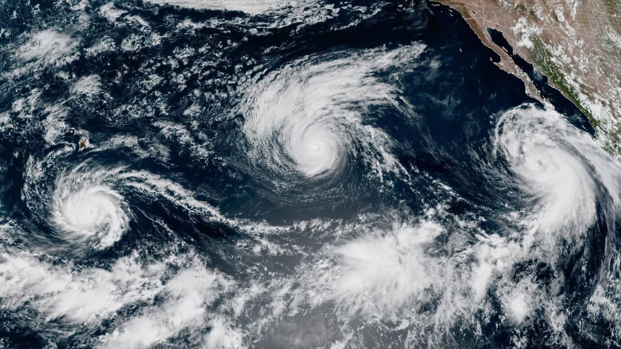
Tropical cyclone intensity prediction requires moving past simple category ratings to evaluate the underlying thermodynamic and kinematic drivers. When a system like Hurricane Lowell reaches Category 4 status while tracking toward an isolated island landmass like Hawaii, standard public advisories often obscure the actual physical mechanisms determining impact severity. Emergency preparation frameworks fail when they rely exclusively on peak wind speeds rather than accounting for forward velocity, structural symmetry, and local bathymetric interactions.
Understanding how a major hurricane threatens a specific region demands a structured breakdown of atmospheric variables, wind field distribution, and the limitations of numerical weather prediction models in oceanic environments.
The Thermodynamic Engine of Category 4 Systems
A hurricane of this magnitude operates as a heat engine governed by sea surface temperatures and atmospheric moisture profiles. To sustain Category 4 intensity, sustained surface winds must reach between 130 and 156 miles per hour, driven by an intense pressure gradient force between the outer environment and the eye.
The primary energy source remains high-enthalpy ocean water, typically requiring temperatures exceeding 26.5 degrees Celsius to a sufficient depth. When a system tracks across warm water pools, vertical shear must remain minimal to prevent the warm core from tilting and venting latent heat.
Sea Surface Temp > 26.5°C + Low Vertical Shear = Sustained Core Warming
External cooling mechanisms disrupt this engine. As a storm approaches higher latitudes or traverses cooler upwelling currents generated by its own slow motion, the enthalpy flux decreases.
Forecasters track ocean heat content rather than just surface temperature because deep warm water layers prevent the storm from churning up cold water from below, a self-limiting feedback loop that often weakens robust systems.
Kinematic Profiles and Wind Field Asymmetry
The damage potential of a hurricane is a vector sum of its internal rotational velocity and its forward translational speed. In the northern hemisphere, the forward motion of the system adds to the rotational vector on the right side of the track, creating a dangerous semicircle of maximum winds.
When a Category 4 system moves toward a landmass, the translational vector dictates the duration of peak wind exposure at any given point along the coast.
- Translational Velocity: A slow-moving hurricane increases cumulative rainfall totals and prolongs structural stress, whereas a fast-moving system minimizes rainfall duration but amplifies wind gusts through momentum transfer.
- Eyewall Dynamics: The inner core undergoes concentric eyewall replacement cycles, a structural reorganization where an outer rainband chokes off the inner eyewall, causing temporary intensity fluctuations while expanding the overall wind field footprint.
- Frictional Discontinuity: As outer rainbands interact with coastal topography, surface friction reduces wind speed while increasing mechanical turbulence, creating sharp localized wind gradients that standard synoptic models miss.
Topographic Modification and Island Orography
Hawaii presents a unique set of hazards during a tropical cyclone encounter due to its steep volcanic topography. High mountain peaks like Mauna Kea and Mauna Loa disrupt the lower-level wind flow, forcing air masses to either ascend or channel around the terrain barriers.
This orographic lifting enhances precipitation efficiency on windward slopes, leading to extreme rainfall rates that trigger flash flooding and catastrophic debris flows far inland from the coast.
Conversely, leeward sides experience severe downslope windstorms as compressed air descends rapidly from high elevations, warming adiabatically and producing erratic, destructive gusts.
Coastal storm surge interacts unpredictably with local bathymetry, narrow shelf widths, and steep shorelines. While shallow continental shelves amplify storm surge by allowing water to pile up efficiently, deep island drop-offs limit the magnitude of wind-driven water accumulation while exposing shorelines to extreme wave action driven by deep-water swell precursors.
Predictive Limitations and Uncertainty Propagation
Meteorological agencies rely on ensembles of numerical weather prediction models to project track and intensity. These models ingest disparate data streams from satellite scatterometers, reconnaissance aircraft, and dropwindsondes.
However, initialization errors in the initial state of the vortex lead to divergent track forecasts over extended time horizons. The physics parameterizations governing cloud microphysics and boundary layer friction introduce persistent uncertainties in intensity forecasts, particularly for intense systems capable of rapid intensification or unexpected decay.
Risk mitigation strategies must account for these forecast confidence bounds rather than treating single deterministic paths as absolute truth. Emergency management protocols deployed too early waste economic resources, while delayed activations compromise life safety during the narrow window before tropical storm-force winds arrive.
Strategic Allocation of Emergency Resources
Resource deployment must scale non-linearly with the radius of maximum winds and the forward speed of the cyclone. Evacuation orders require precise timing models that factor in infrastructure bottlenecks and clearance times for vulnerable coastal sectors.
Grid hardening, localized asset prepositioning, and redundant communication networks mitigate the cascading failures typical of severe wind events.
Supply chain pre-positioning must prioritize high-elevation staging areas to avoid initial flood zones while maintaining direct access routes to impact corridors once the primary hazard front clears the regional airspace.