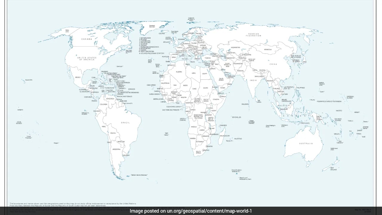
International bodies rarely revise their standard projections without triggering diplomatic friction. When the United Nations General Assembly adopted the African Union-backed "Correct the Map" resolution—a procedural push designed to address cartographic equity and equal-area representation—New Delhi threw its weight behind the initiative. It looked like a routine multilateral consensus on geographic proportions. Then the fine print surfaced.
The UN Geospatial Office reference map accompanying the initiative depicts Arunachal Pradesh and Aksai Chin not as integral parts of India, but as isolated zones suspended between competing Indian and Chinese claim lines. The document strips away Arunachal Pradesh's administrative boundary with Nagaland while setting its northern edge against Tibet as a mere "Indian Line". Aksai Chin is similarly cordoned off, trapped in a grey zone of unmarked demarcation.
India's Ministry of External Affairs scrambled to contain the fallout, issuing statements clarifying that supporting equal-area cartographic projections does not constitute an endorsement of specific boundary lines. Yet the damage was done. A diplomatic miscalculation of monumental proportions had slipped past routine committee checks, exposing how international technocratic bodies routinely codify territorial disputes under the guise of technical modernization.
The Mechanics of Multilateral Cartography
Global institutions rely on standardized base maps for data visualization, peacekeeping coordination, and demographic reporting. These templates carry immense legal and psychological weight, even when formally declared non-binding.
For decades, foreign ministries have treated UN cartography as a secondary battleground. Bureaucrats focus their political capital on high-profile plenary debates while technical drafting divisions quietly determine how disputed frontiers are rendered. The July draft prepared by the UN Geospatial Office followed an insidious pattern of asymmetry.
Consider how the map treats Jammu and Kashmir. A clear explanatory footnote accompanies the dotted line representing the Line of Control, explicitly noting that the final status of the region remains unresolved between India and Pakistan. No such explanatory text accompanies the frontier lines around Arunachal Pradesh or Aksai Chin. They exist as orphaned territories on the sheet, stripped of explanatory qualifiers yet burdened with dual-line nomenclature that elevates Beijing's illegal claims to institutional equivalence.
Diplomatic Blind Spots and Bureaucratic Silos
Why did New Delhi's diplomatic corps back a resolution carrying a pre-drafted map without vetting its visual attachments?
The answer lies in the structural disconnect between multilateral policy wings and technical mapping desks. South Block viewed the "Correct the Map" agenda through the lens of South-South solidarity and administrative equity. The primary political objective was supporting a reform movement championed by African nations to correct Eurocentric map distortions.
Negotiators treated the vote as an abstract mathematical correction rather than a territorial contest. They missed the operational reality of how international secretariats function. Once a draft map enters circulation within UN workflows, altering its vector lines requires a grueling administrative counter-offensive. Foreign ministries across Western capitals and Asian power centers now possess a neutral, UN-stamped graphic they can cite in academic publications, geostrategic indexes, and intelligence briefings.
The Real-World Cost of Graphic Redefinition
Maps are never neutral drawings. They are political instruments that freeze historical coercion into visual reality.
When Beijing issued its aggressive "standard map" asserting sovereignty over vast swaths of Indian territory, New Delhi responded with swift diplomatic rejections. Those bilateral protests carried weight because they opposed a partisan, unilateral act by a rival capital. Fighting a partisan map issued by a rival is straightforward. Correcting a neutral template published by the United Nations is an entirely different operational nightmare.
Multilateral bodies institutionalize ambiguity to maintain administrative consensus. By reducing disputed sovereign ground to floating zones between unspecified claim lines, the UN effectively normalizes the permanence of border disputes. It rewards persistence of occupation over legal title. For residents of Arunachal Pradesh, whose citizenship and electoral mandates are constitutionally anchored in Indian democracy, seeing their homeland rendered as a geopolitical vacuum on global dashboards is an unacceptable security hazard.
Reversing the Cartographic Slide
Mitigating this diplomatic breach requires an aggressive, multi-pronged counter-strategy from Indian delegations in New York and Geneva.
First, the External Affairs Ministry must bypass routine plenary channels and engage directly with the UN Committee of Experts on Global Geospatial Information Management. Technical standards must be forced to align with domestic legal realities. Second, New Delhi must demand an explicit cartographic footnote on all UN reference sheets—mirroring the treatment applied to other global flashpoints—clarifying that northern frontier depictions do not prejudice India's sovereign claims.
Relying on verbal disclaimers left behind in press briefings is no longer sufficient. If global institutions insist on drawing the lines of the future, India must ensure those lines reflect reality rather than the tactical ambitions of its adversaries.